Introduction
Welcome back to our Tour du Mont Blanc (TMB) series, where we’re sharing our unforgettable day-by-day journey through one of the most iconic long-distance trails in the world. Each post takes you along the highs, lows, and breathtaking scenery that make this adventure so special.
This post covers Day 3, where we hiked the alternate route from Col de la Croix du Bonhomme to Rifugio Elisabetta, following the scenic Col des Fours trail. Along the way, we accidentally added an unplanned visit to the Tête Nord des Fours, a stunning summit that turned out to be an unforgettable detour.
If you’re planning your own TMB adventure, don’t miss our complete Half TMB guide for everything you need to know. And in case you need a map, we’ve created our own Tour du Mont Blanc Google Map, which includes all the trails and locations you’ll need.
We took on this stage at the end of June, a perfect time to experience the trail as the early summer blooms brought the Alps to life.
Stage 3 Hiking Stats: (Official/Variante)
- Distance: 13,8 km/17km
- Highest point: 2,512m/2,727m
- Lowest point: 1,579m/1,777m
- Elevation gain: 1,175m/1,214m
- Elevation loss: -540m/-1454m

Read: The Ultimate 11-Day Tour du Mont Blanc Hiking Guide
TMB Col des Fours to Rifugio Elisabetta
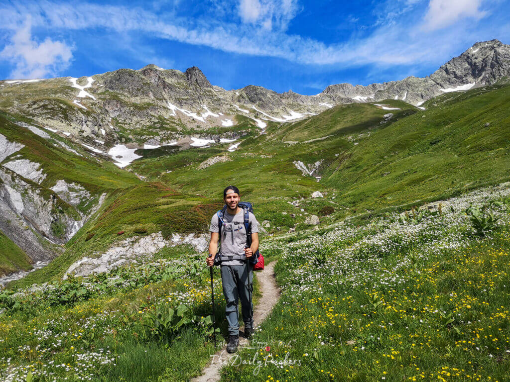
Refuge de la Croix du bonhomme to Col des Fours
We woke up around 6 a.m. to a breathtaking view of the Alps, a perfect start to the day. After soaking in the scenery, we packed our gear and headed to the refuge for breakfast and to use the bathroom. By 7:30 a.m., we set off for Col des Fours, with the trail conveniently located right behind the refuge.

We chose this alternate route because we initially planned to take a bus from Chapieux to Refuge des Mottets and combine two stages. However, since buses weren’t running yet in late June, we opted for this alternate trail, which is far more scenic than the regular route.
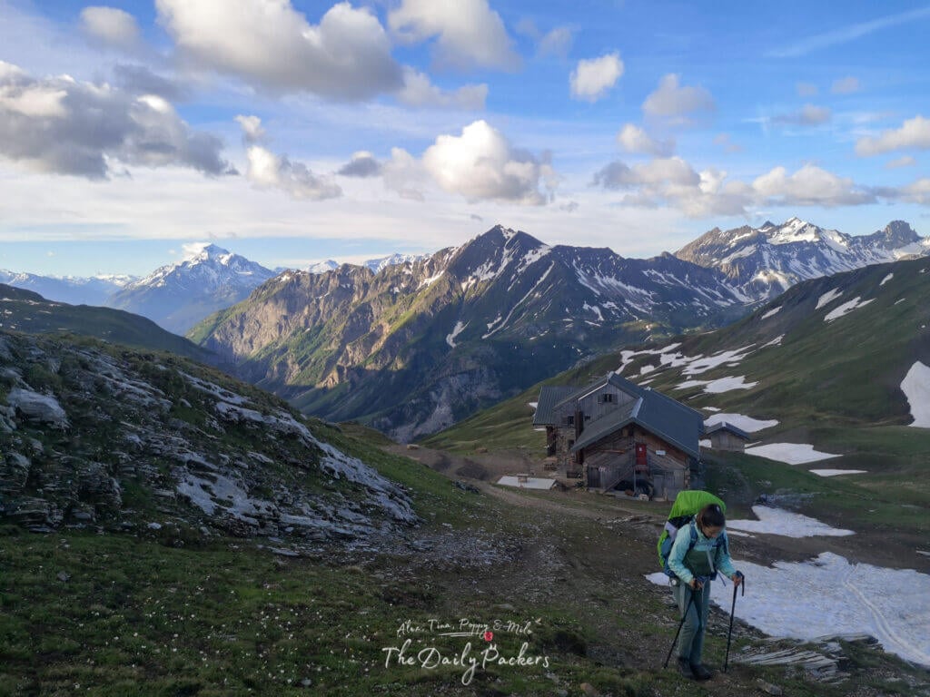
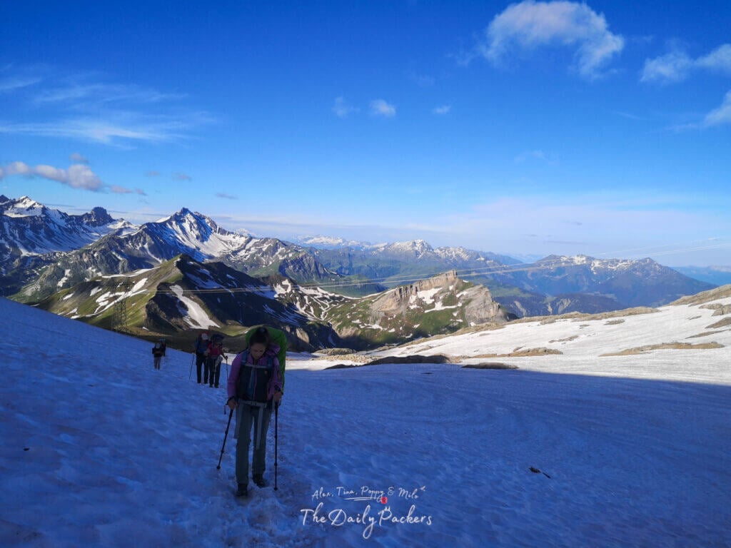
The trail itself wasn’t too difficult, though some sections were still covered in snow. Thankfully, it was nothing too challenging to navigate, and by around 8 a.m., we had reached the col.
On this alternate route, we encountered just a handful of fellow hikers—10 in total. This included a group of six, and two others from the refuge who were moving at an impressively fast pace!

Tip: We used this MSR tent — super reliable, easy to set up, and held up perfectly in all weather conditions.
Tête Nord des Fours
We continued along the trail but, by mistake, ended up at Tête Nord des Fours (2,756 m). The alternate trail isn’t particularly well-marked, which led to this unexpected but incredible detour.

From Col des Fours, the Tête Nord is hard to miss—a large platform stands prominently on the summit, and the path naturally leads upward to it. Despite being unplanned, this spot became one of our absolute favorites on the entire TMB.
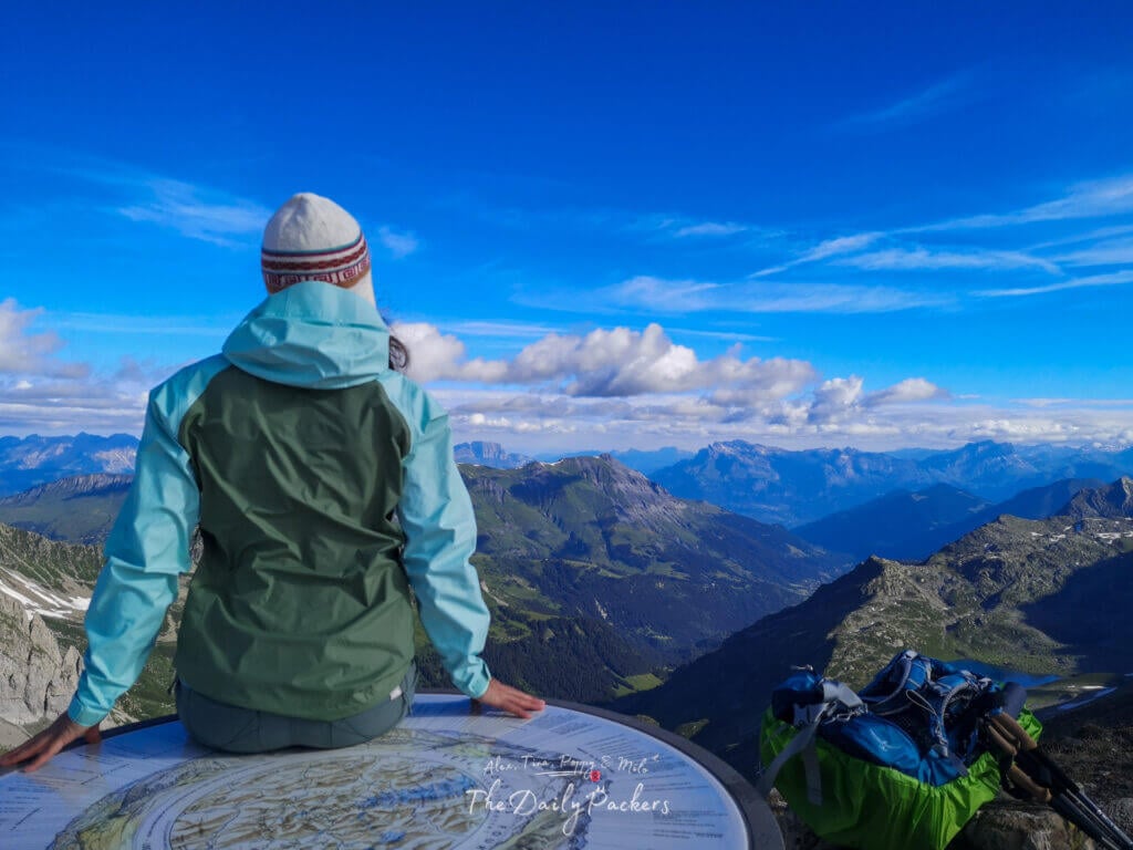
At the top, it was just us, surrounded by breathtaking views and complete tranquility. The experience felt surreal, like having the Alps all to ourselves. After taking it all in, we made our way back to Col des Fours the same way we had come.

Col des Fours to La Ville des Glaciers/Refuge Mottets
From Col des Fours, the descent in late June was entirely covered in snow, turning it into a fun and unique part of the hike. Tina embraced the conditions, sliding and almost skiing down the snowy slopes. Fortunately, the descent wasn’t too difficult, and we didn’t need crampons to navigate it safely.

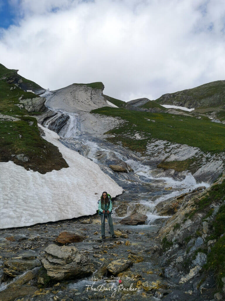
Once we made it out of the snow, we followed the left edge of a melted snow river as it wound its way down the valley. At one point, there was another trail that we were supposed to take, but it was inaccessible. With no signs in sight, we weren’t entirely sure if we were still on the right track, but we continued along the river anyway.
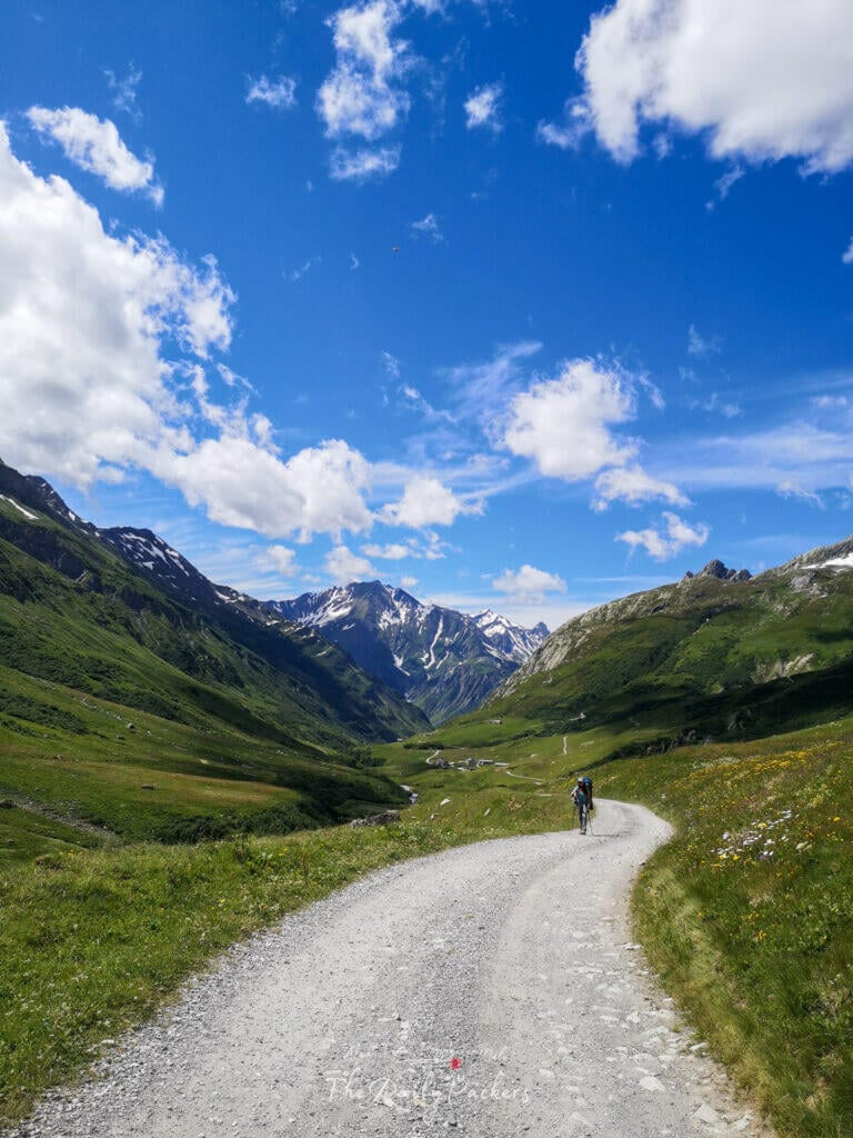
By 11 a.m., we had reached the valley floor, arriving at the ruins of a small chapel. From there, the trail turned into a pleasant path leading toward the refuge.
Hoping to shorten the hike, we decided not to follow the official road designed for cars. Instead, we ended up past the bridges at Ville des Glacier, where we were supposed to rejoin the official TMB route. Opting to stay on this side of the river seemed like a good idea at the time, but it turned out to be less than ideal. While the trail wasn’t significantly harder, it was longer, making the final stretch to Les Mottets feel more drawn out than expected.
Tip: Always travel with a filtered water bottle — it saves money, reduces plastic waste, and keeps you hydrated wherever you go.
Refuge Les Mottets to Col de la Seigne
We took our lunch break at Refuge Les Mottets, where we dried our tents, refilled our water bottles, and rested for a while. By 12:45 p.m., we were back on the trail, heading toward Col de la Seigne, the border between France and Italy.

The climb to Col de la Seigne felt more challenging as the day progressed, and for good reason—today’s stats were no small feat:
- Col de la Croix du Bonhomme (2,412 m) to Tête Nord des Fours (2,756 m)
- La Ville des Glaciers (1,700 m) to Refuge des Mottets (1,864 m)
- Col de Seigne (2,516 m) to Rifugio Elisabetta (2,195 m)

With over 996 meters of ascent and 1,377 meters of descent, this stage turned out to be one of the more demanding days of our TMB journey.

Tip: We hike with Osprey backpacks and can’t recommend them enough — the Talon 44 and Tempest 40 are comfortable, durable, and great for any adventure.
Col de la Seigne to Rifugio Elisabetta
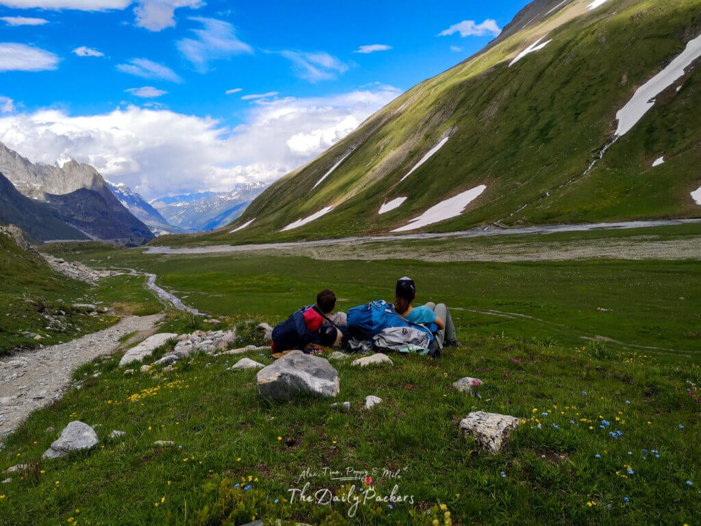
From Col de Seigne, the trek down to Rifugio Elisabetta was nothing short of delightful. Once we descended a bit and left the snow behind, the trail transitioned into a gentle downhill path winding through a breathtaking valley.

This valley was alive with wildlife, particularly marmots! We took a few breaks along the way, staying as quiet as possible to avoid startling them.
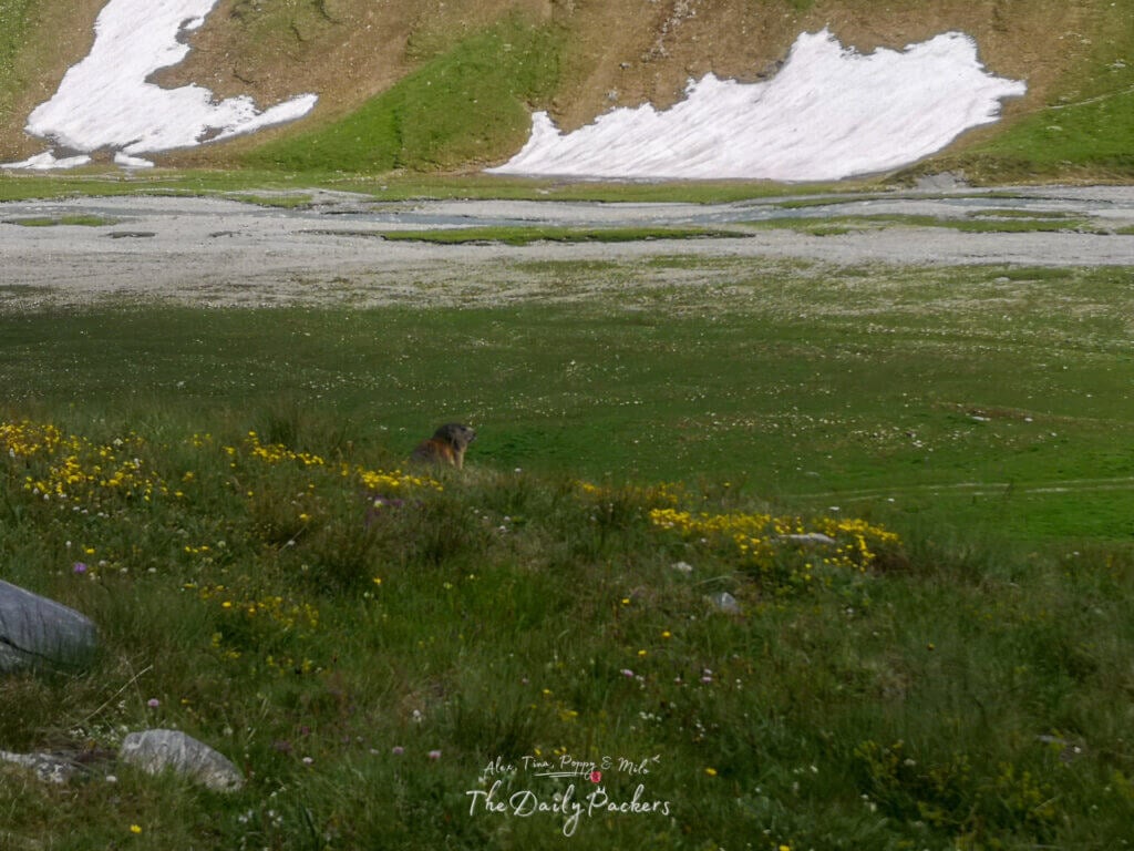
Our patience paid off as we found ourselves surrounded by these adorable creatures, an unforgettable moment of connection with nature. 😊
Check our Google Map of the Tour du Mont Blanc
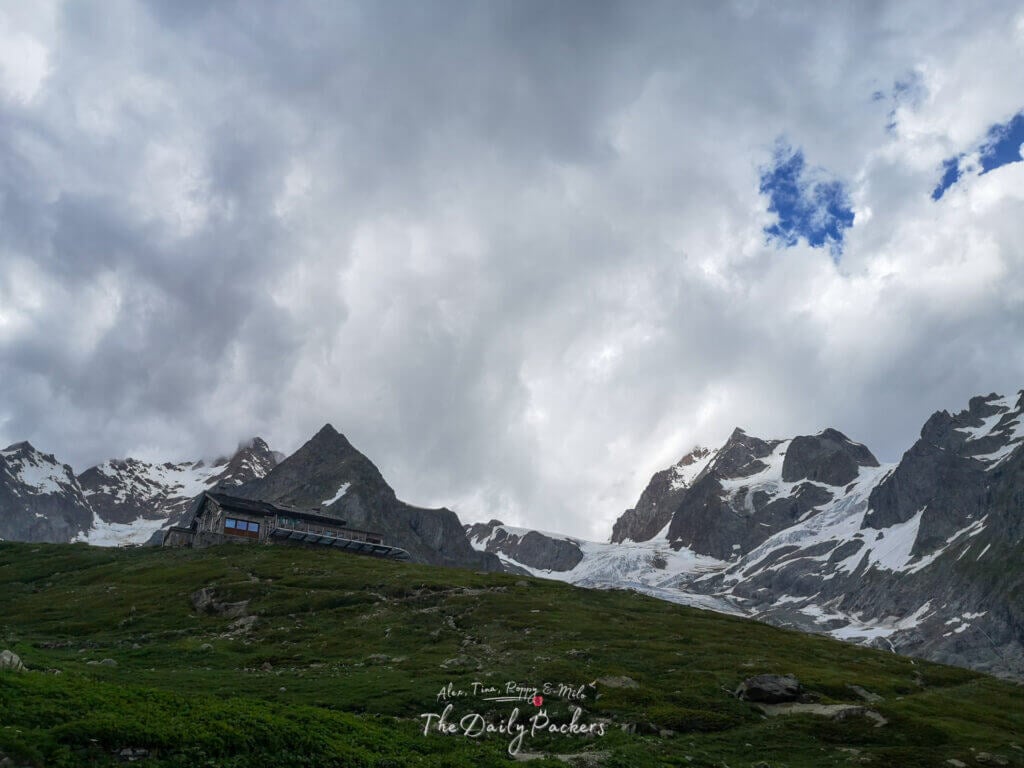
Rifugio Elisabetta
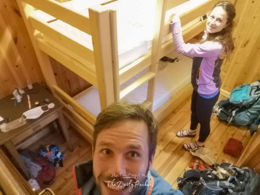
Since wild camping is strictly prohibited in Italy, we stayed at Rifugio Elisabetta for the night. We arrived around 5 p.m. and inquired about room availability. Fortunately, there were still options: a dormitory for four people (€48 per person, half board) or a private room for two (€62 per person, half board). Due to COVID-19 precautions, the refuge preferred that we stay in a private room, so we opted for it.
The half-board option is mandatory, and it includes dinner and breakfast. We requested a vegetarian meal, which they were happy to accommodate.
Showers were available for an additional €2. The refuge had two separate bathrooms (men/women) upstairs, each with two toilets and one shower. Additionally, there was a mixed bathroom downstairs with two toilets and two showers. Toilet paper was provided, but no soap was available, so bringing your own toiletries is essential.

Dinner was simple but delicious. It began with a small toast topped with cheese (and dried meat for non-vegetarians), followed by risotto. The main course included potatoes with green beans, paired with either meat or cheese for the vegetarian option. Dessert was a rich chocolate flan, a perfect way to end the meal.
The refuge was lively, filled with an eclectic mix of fellow hikers. There was a group of six French retirees who had also taken the alternate route (three older couples), a French/Chilean couple, a Polish family of three we’d crossed paths with several times during the day, two elderly Italian men—one of whom seemed to know more about the history of our countries than we did—and another group of three hikers.
Breakfast was simple but sufficient, offering coffee or tea along with a variety of jams, chocolate spreads, bread, and biscuits to fuel us for the day ahead.

Tip: We never travel without our DJI Mini 3 PRO drone anymore — it’s totally worth having to capture places from a whole new perspective.
Anecdote
Based on the weather forecast, our journey from Col de la Croix du Bonhomme to Rifugio Elisabetta was expected to be rainy, starting early in the afternoon and continuing through the next day. Thankfully, the rain held off much longer than predicted, and a heavy storm only began around 7 p.m., after we were safely settled in the refuge.
By morning, the skies had cleared completely, offering perfect weather for hiking. We felt incredibly grateful to have stayed at the refuge that night, warm and dry, as the storm raged outside.
Read: The Ultimate 11-Day Tour du Mont Blanc Hiking Guide
About the authors
We are Alex and Tina, a French-Serbian couple who met in China back in 2014. We spent three incredible years there before making France our home. Our shared passion for travel has been the heartbeat of our relationship for over 12 years, taking us across 44 countries and counting.
We launched TheDailyPackers in 2019 as a way to document our adventures. In 2026, we reached a major milestone by officially turning our blog into our full-time job. While we are still growing toward financial independence through this platform, every article we write is fueled by our mission to make your voyages easier through in-depth guides, honest advice, and the lessons we’ve learned from our own mistakes.
Our journey has not been without its storms. In 2023, our world changed forever when our first son, Poppy, was stillborn on November 25th. It was, and remains, the hardest chapter of our lives. In 2025, we were blessed with our second little boy, Milo. He has since joined our traveling tribe, and you’ll be seeing him—and the reality of traveling with a little one-on the blog more and more.
We hope to inspire you to explore the world with curiosity and resilience. Thank you for being part of our story.
You may also like those related posts
7 best things to do in Fortaleza, Brazil, in 2 days
6 Best Tourist destinations in Uruguay in 2026
Easter Island Road Trip: A Perfect 1-Day Adventure
5 Best Things to do in Remedios, Cuba, in 1 single day
7 Best Christmas Markets in Alsace, France
The Perfect 2-week Cuba itinerary for first-timers
Holafly eSIM Review: The Best eSIM for Digital Nomads?
Easter Island National Park: Best 1-Day Hiking Adventure
Pssst, did you know that…
If you purchase something through our links, we earn a small fee. However, you still pay the same. Win-win! And one day we may get to be full-time travel bloggers =)
Find Hotels with Booking.com
Do Yoga with KVY
Buy us a Coffee
Rent a car with DiscoverCars
Find Attractions with GetYourGuide
Find Flights with Expedia
Buy an eSIM with Airalo
Get insured with World Nomads
Get ready with Amazon.com