
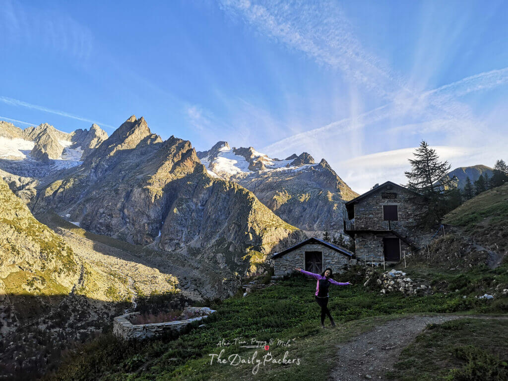
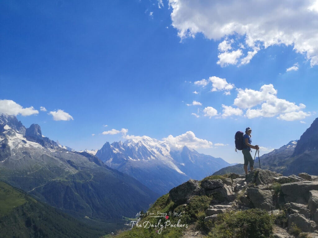
Introduction
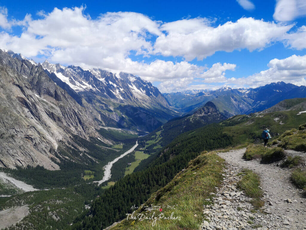
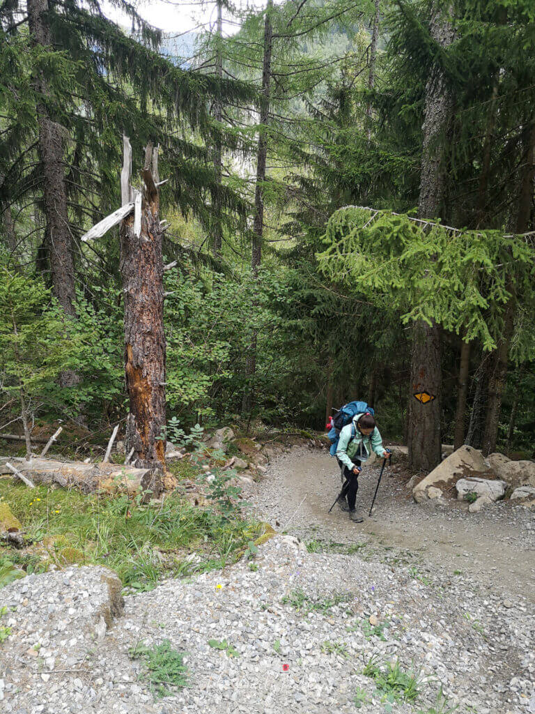
The Tour du Mont Blanc, also known as the TMB, is a 170km hike that goes through France, Italy, and Switzerland. It brings you all around the highest mountain in Europe. It can be completed in 5 to 11 days or even more, depending on how you want to tackle the 11 official stages and their variants.
An alternative is a 4-day half Tour du Mont Blanc. So, if you are unsure, you can do all the 11 stages, or if you want to try it out, you could start with this. The Tour du Mont Blanc has an official route, but also has many variants.
Along your way, you will need to choose if you want to follow the original trail or use a variant that may be even better. We actually went 3 times on the Tour du Mont Blanc, and that’s why we are writing this complete Tour du Mont Blanc Guide to help you in your self-guided hike around one of the most beautiful mountain chains in Europe.
If you want to get deeper into the Tour du Mont Blanc, we have a complete series of articles:
- 12 best Tour du Mont Blanc tips
- The Best Tour du Mont Blanc Packing list 2025
- 15 Proven ways to shortcut the TMB
- 10 Easy Ways to Escape the TMB

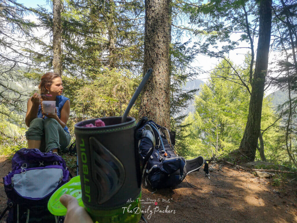
Tip: We hike with Osprey backpacks and can’t recommend them enough — the Talon 44 and Tempest 40 are comfortable, durable, and great for any adventure.
About the Tour du Mont Blanc
Introduction
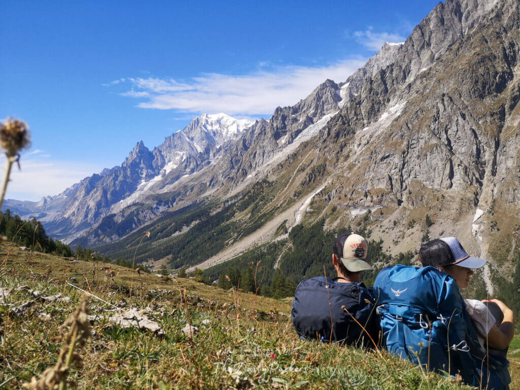
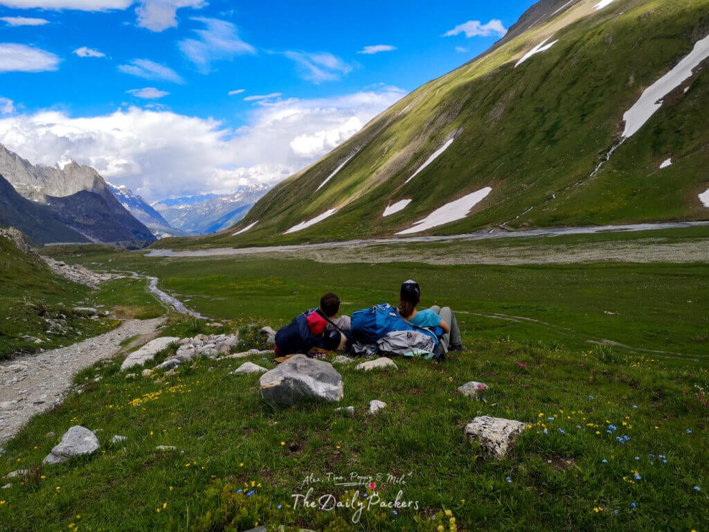
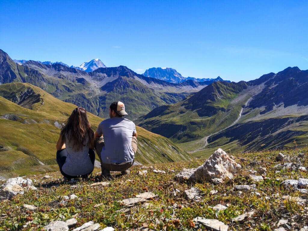
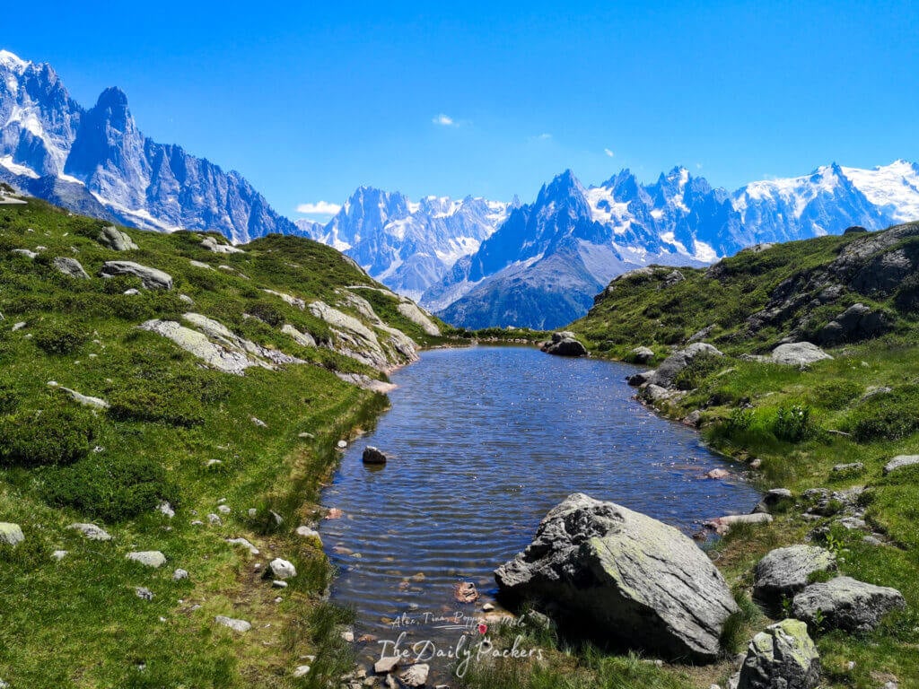
Le Tour du Mont Blanc is one of the most spectacular trails in the world. The trail consists of 11 stages and over 10 variants. Along the way, hikers can choose which option they prefer. Its route passes through beautiful valleys, adorable hamlets, charming landscapes, rugged mountains, crystal clear rivers, and white snow.

Tip: We use the DJI Action 4 to film our vlogs — compact, durable, and perfect for capturing every adventure.
The official stages
Likewise, you can hike the Tour du Mont Blanc both clockwise and anti-clockwise. However, hikers traditionally do it anti-clockwise and start in Les Houches (France). Just a few people chose the clockwise option and would usually start in Champex (Switzerland)
- Stage 1: Les Houches to Les Contamines
- Stage 2: Les Contamines to Les Chapieux
- Stage 3: Les Chapieux to Rifugio Elisabetta
- Stage 4: Rifugio Elisabetta to Courmayeur
- Stage 5: Courmayeur to Rifugio Bonatti
- Stage 6: Rifugio Bonatti to La Fouly
- Stage 7: La Fouly to Champex
- Stage 8: Champex to Col de la Forclaz/Trient
- Stage 9: Trient/Col de la Forclaz to Tre-le-Champ
- Stage 10: Tre-le-Champ to Refuge La Flegere
- Stage 11: Refuge La Flegere to Les Houches
Read: The Ultimate Half Tour du Mont Blanc Hiking Guide: Your Half Adventure
Weather
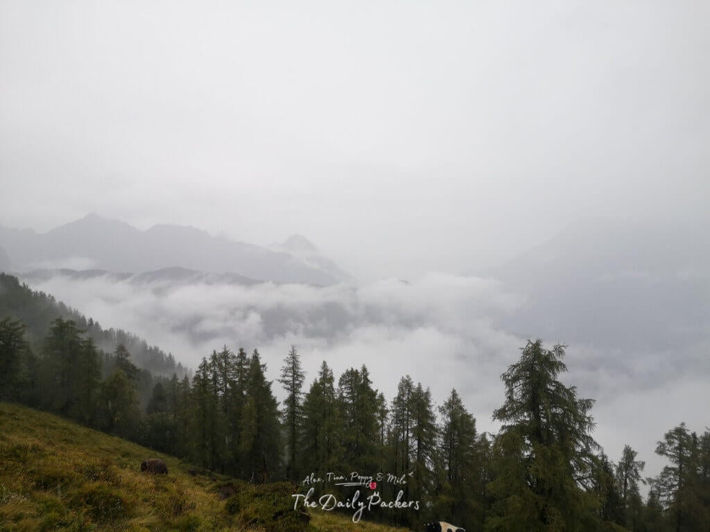
Mountain weather is unpredictable and constantly changing, making most weather apps and forecasts unreliable in advance. For reference, we hiked the Tour du Mont Blanc at the end of June and experienced sunny days with only one rainy night, despite a different forecast.
We also trekked in mid-July, where the weather was exceptionally sunny—even too hot at times. However, during our late August to early September attempt, we had to stop due to four consecutive days of nonstop rain.
Best time to hike the Tour du Mont Blanc
Officially, the Tour du Mont Blanc opens from mid-June to mid-September.
- The middle of June is a great time to hike the Tour du Mont Blanc as the trail will be almost empty. But you will have to deal with snow-covered sections on the trail, or you won’t be able to use the variant you wanted to.
- The end of June is probably the best time to be on the Tour du Mont Blanc. Most of the snow is already melted, and what’s left is trekkable. Plus, the crowd will not yet be there. And you will not need to organise everything in advance. (That is the time we chose)
- The middle of July and August is the busiest time on the trek, but also the time when the trail will be fully available.
- September will again be less crowded. But the weather will also become colder and with higher chances of rain.

Tip: We never travel without our DJI Mini 3 PRO drone anymore — it’s totally worth having to capture places from a whole new perspective.
How difficult is the Tour du Mont Blanc
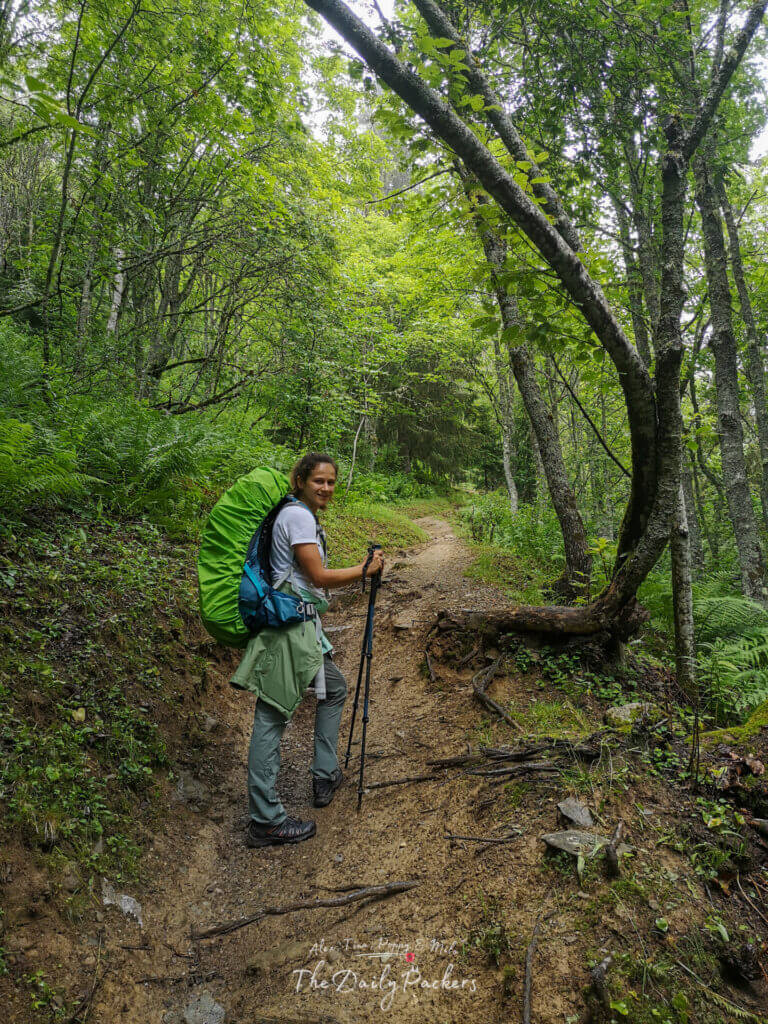
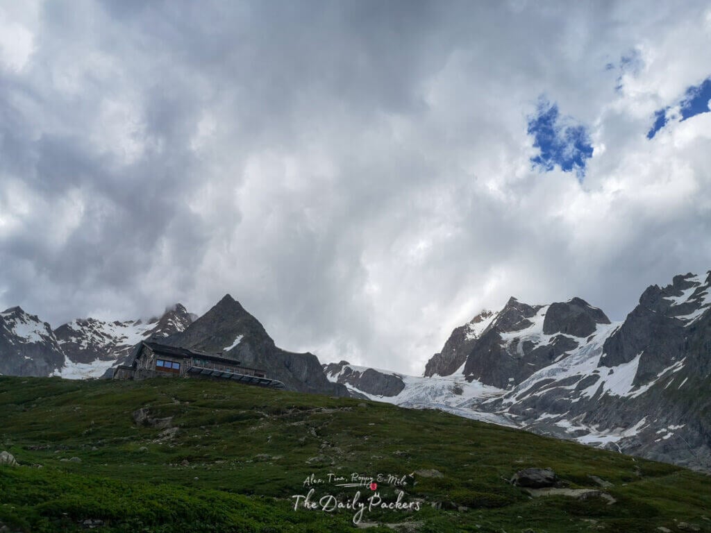
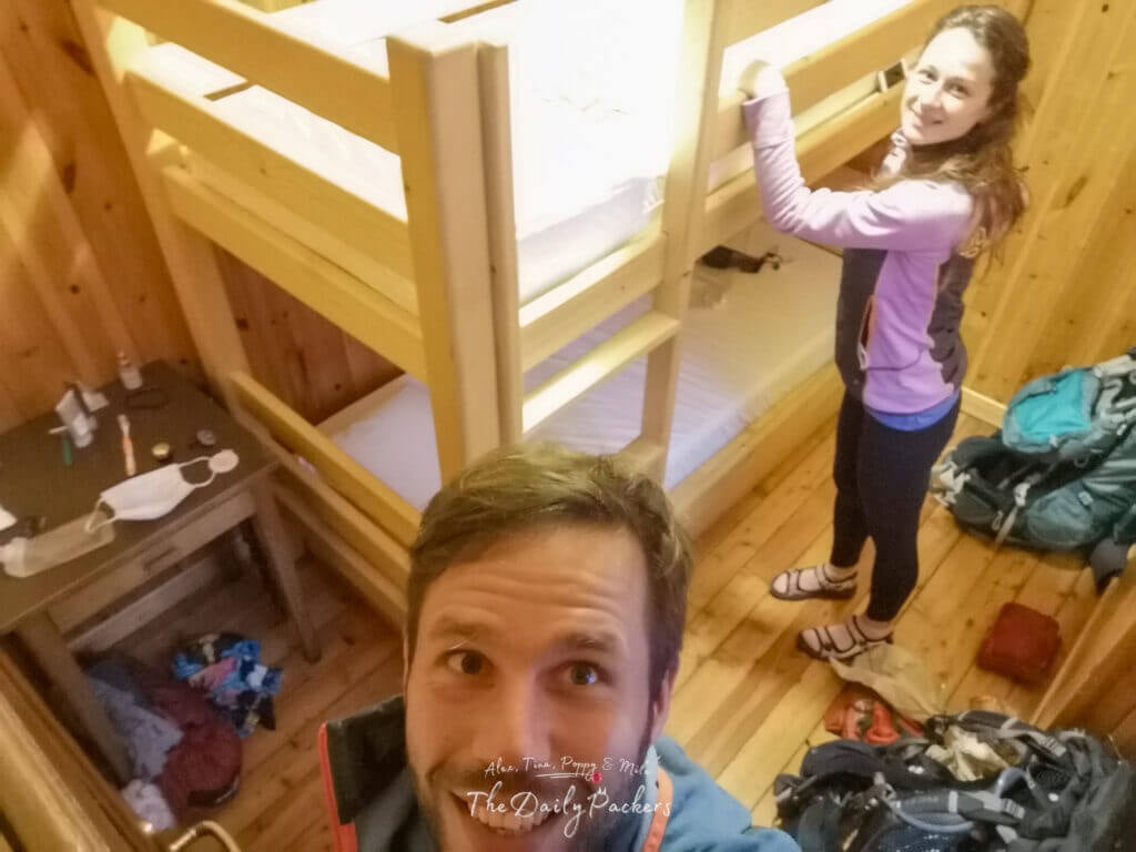
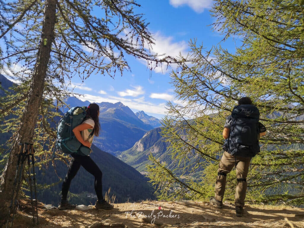
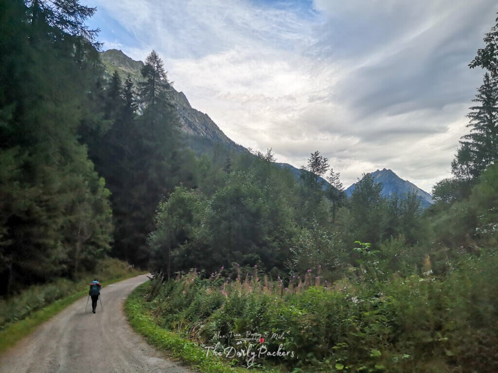
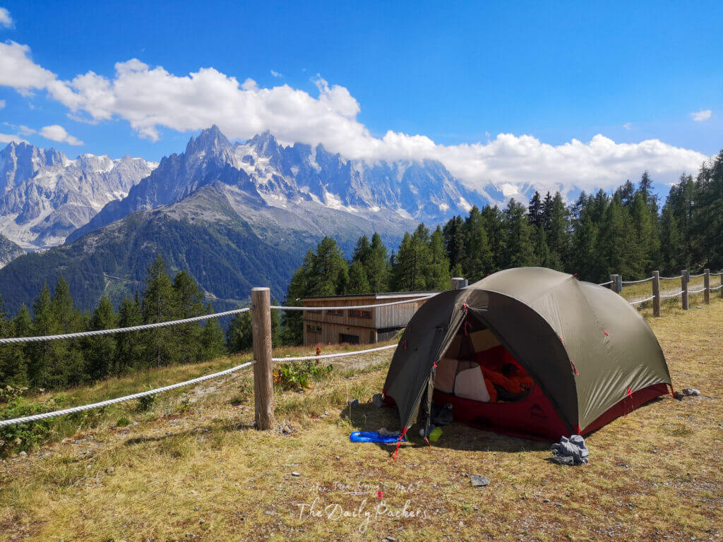
It is a demanding trail, you are looking at long days with breath-taking views. Most importantly, you will ascend to the mountain and descend to the valley continuously and day after day. Above all, some days you will walk over 1000m up/down. What can affect your trail the most is your decision about staying in mountain huts or camping. As a camper, you will have to carry more gear and your backpack will be heavier.
There is only one technical part which isn’t too hard and it is the ladder on the Stage 10.
Food & Water
Firstly, the Tour du Mont Blanc passes through many villages. So you will be able to buy food regularly and will not need to carry it in your bags. If you do not want to bother, you can also eat in mountain huts along the way. Most of them offer lunch menus. And if you stay overnight, they even offer lunchboxes.
Secondly, if you are a vegetarian, you will also be able to find alternatives. But vegans will have a harder time and will probably have to cook their own meals.
Thirdly, you can find water easily along the road, so no need to carry 3L of water with you, as there are many wells around. Plus, most of the shelters will refill it for you.
Tip: Always travel with a filtered water bottle — it saves money, reduces plastic waste, and keeps you hydrated wherever you go.
The money stuff
In short, in towns most of the places accept credit cards, but up in the mountains, cash will be the only means of payment. Be sure that you carry enough of it with you. Meanwhile, in Italy and France, the currency is the euro. Switzerland uses the Swiss Franc but often accepts euros.
Check our Google Map of the Tour du Mont Blanc
Mobile network
Well, on most of the trek, you will be able to get a cellular network, but don’t expect to be online all the time. For example, from Col des Fours to Col Chécrouit, there is no network. But that’s really only for a short part of the trek where you won’t especially need mobile networks.

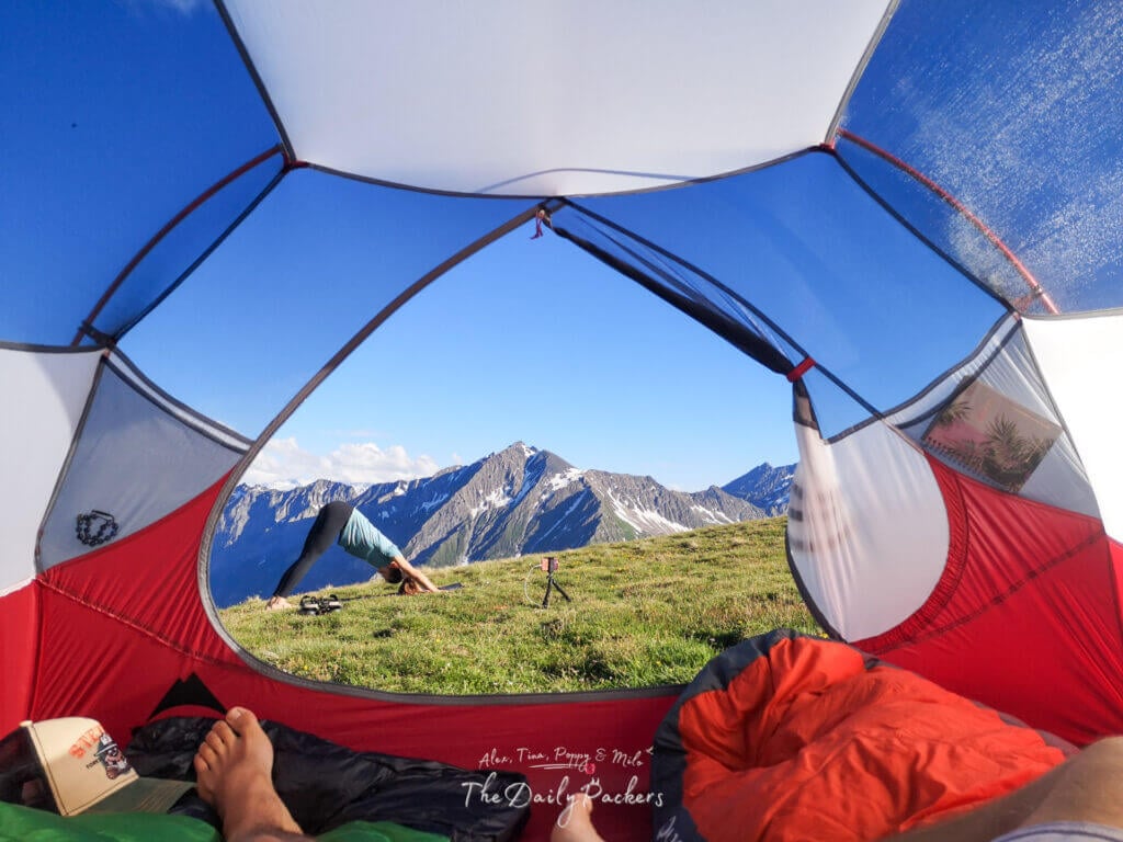
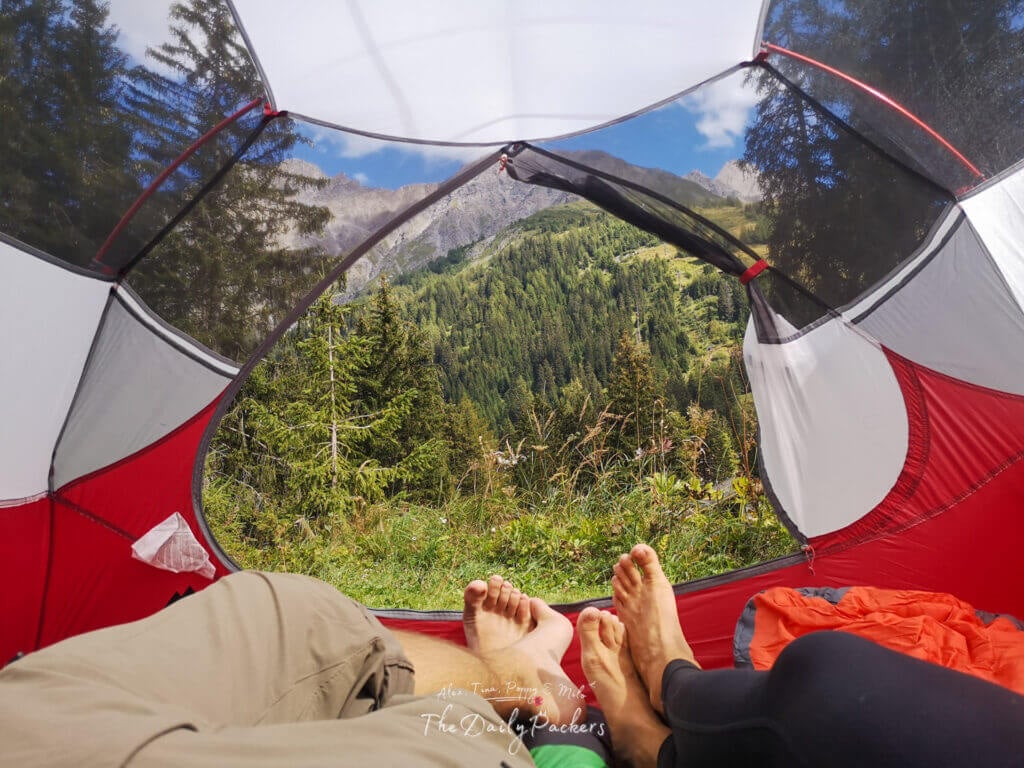
Wild Camping
Wild Camping is not recommended at all and often prohibited:
- In Italy, wild camping is strictly prohibited, and you should avoid doing it. The local authorities and people do not joke with it. Italian law says: free camping is forbidden (allowed only above 2.500 m from sunset to dawn)
- In Switzerland, it is the same; wild camping is simply and strictly prohibited. And people would denounce you to the authorities.
- In France, it is another story. And you can wild camp without too much trouble. As the local law says, ‘free camping is allowed only at high altitude between sunset and sunrise’. But without a clear definition of the altitude.

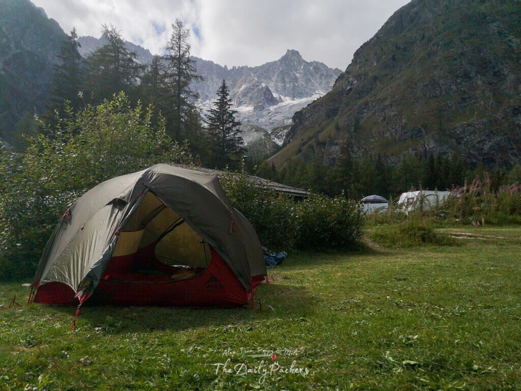
Tip: We used this MSR tent — super reliable, easy to set up, and held up perfectly in all weather conditions.
The Tour du Mont Blanc Guide
Introduction
The official starting point of the Tour du Mont Blanc is in Les Houches, France, where we both began and ended our trek. Throughout the journey, we opted for some variant routes whenever possible, allowing us to experience even more breathtaking landscapes. In the end, our preferred route is:

Tip: We hike with Osprey backpacks and can’t recommend them enough — the Talon 44 and Tempest 40 are comfortable, durable, and great for any adventure.
Overview
- Day 1: Les Houches – Col de Voza – Bionnassay – Champel – Tresse – Les Contamines-Montjoie
- Day 2: Les Contamines-Montjoie – Notre-Dame-de-la-Gorge – Nant Borrant – La Balme – Col du Bonhomme – Col de la Croix du Bonhomme
- Day 3: Col des Fours – Tête Nord – La Ville des Glaciers – Mottets – Col de la Seigne – la Casermetta – Refuge Elisabetta
- Day 4: Refuge Elisabetta – Lac Combal – Arp-Vieille supérieure – Lac Chécrouit – Col Chécrouit – Plan Chécrouit – Dolonne – Courmayeur
- Day 5: Courmayeur – Rifugio Bertone – Rifugio Bonatti
- Day 6: Rifugio Bonatti – Chalet Val Ferret – Rifugio Elena – Grand Col Ferret – La Peule – Val Ferret – La Fouly
- Day 7: La Fouly – Saleinaz – Champex
- Day 8: Champex – Plan de l’Au – Bovine – Trient – Le Peuty
- Day 9: Le Peuty – Col de Balme – Aiguillette des Posettes – Tre-le-champ
- Day 10: Tre-le-champ – Lac de Cheresys – Lac Blanc – La Flégère
- Day 11: La Flégère – PlanPraz- Brévent – Col de Brévent – Les Houches
Tip: Always travel with a filtered water bottle — it saves money, reduces plastic waste, and keeps you hydrated wherever you go.
The Tour du Mont Blanc Stage by Stage
Day 1: Les Houches – Les Contamines
f you’re planning to start the Tour du Mont Blanc on the same day you arrive, it’s totally doable. Many hikers begin their trek around 11 AM, which still gives enough time to complete the first stage. We left by car at 5 AM and arrived in Les Houches by 11 AM, ready to hit the trail.
Where to Park in Les Houches
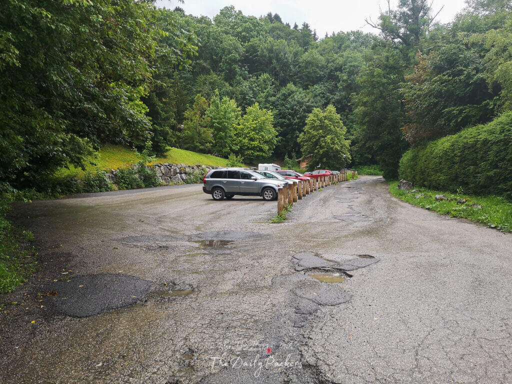
- If you’re driving, there’s a free official Tour du Mont Blanc parking lot behind the cable car station “Le Prarion”. It’s located at: 31 Chemin du Verney du Fouilly, 74310 Les Houches
- Once you arrive, follow the “Tour du Mont Blanc Parking” sign all the way to the end of the road. Avoid parking near the cable car station, as that area is for day visitors.
Getting to Les Houches from Chamonix: If you’re coming from Chamonix, free shuttle buses run regularly to Les Houches, making it super easy to reach the trailhead.
If you want a more relaxed start, consider arriving in Les Houches the day before and staying overnight in a camping or hotel to get a good rest before beginning the trek.
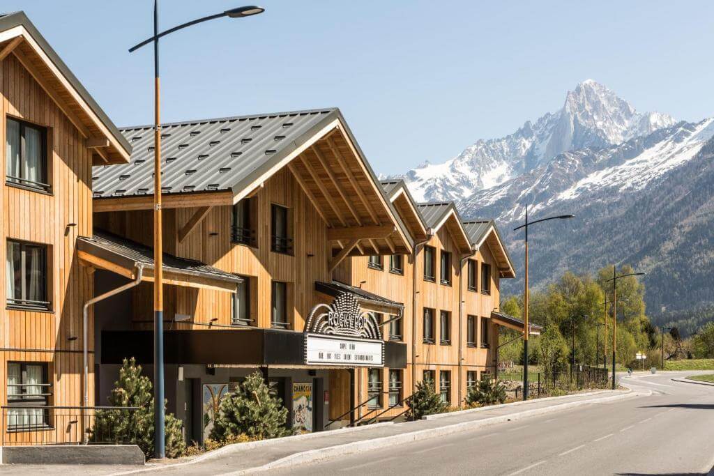
Where to stay in Les Houches: Camping Bellevue, Camping Le Pontet, or a Hotel for more comfort. We would recommend staying at RockyPop
There are several places where you can officially start the Tour du Mont Blanc, depending on where you’re staying. The most common starting points are near the Bellevue cable car or the Le Prarion cable car station in Les Houches.
To find the trail, look for a Tour du Mont Blanc sign followed by one of these destinations:
- Col de Voza
- Bionnassay
- Champel
- Tresse
- Les Contamines-Montjoie
Tour du Mont Blanc Stage 1 Hiking Stats:
- Distance: 5 km
- Highest point: 1,653m
- Lowest point: 1,000m

The trail wastes no time. Stage 1 gives you a taste of the climb-and-reward rhythm that defines the TMB. Expect a steady uphill through forests and alpine meadows before reaching Col de Voza, where sweeping views of the Mont Blanc massif open up.
From there, the path continues past quaint hamlets and traditional chalets, eventually descending into the valley of Les Contamines-Montjoie, your stop for the night.
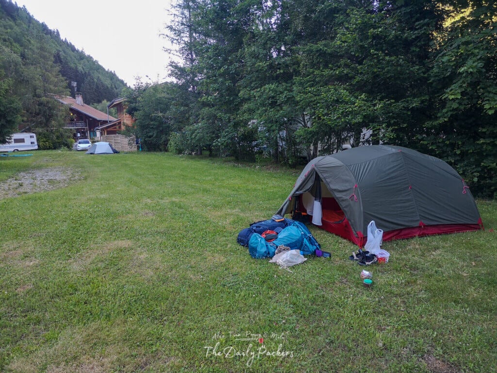
Where to Stay Overnight: At the end of the first stage, you can set up camp or stay in a gîte at Le Pontet.
Located about 40 minutes (3-4 km) after Les Contamines, Camping Le Pontet is a great overnight stop along the Tour du Mont Blanc. If you prefer to save energy, you can take the free shuttle from Les Contamines, which conveniently drops you off right in front of the camping area.
- Service: Toilets, hot showers, electricity at the shower area, sinks, café/bar, covered and open area for cooking.
- Online: 4G coverage of the area
- Cost: 17€ for two with our tent.
Read: Stage 1: Les Houches to Les Contamines
Variant 1: Bivouac Nant Borrant
If you continue along the Tour du Mont Blanc trail for about one more hour beyond Camping Le Pontet, you’ll reach Refuge de Nant Borrant. This is a great option for those looking to shorten the following day’s hike.
- Service: Dry toilets, drinkable water at the shelter, meals available at the shelter.
Variant 2: Refuge de la Balme
If you continue hiking for another hour beyond Refuge de Nant Borrant, you’ll reach Refuge de la Balme. This is another great option to spend the night before tackling the next stage of the Tour du Mont Blanc (TMB).
- Service: Public toilets, drinkable water, sinks, meals available at the shelter
Check our Google Map of the Tour du Mont Blanc
Day 2: Les Contamines – Col de la Croix du Bonhomme
Route: Les Contamines-Montjoie – Notre-Dame-de-la-Gorge – Nant Borrant – La Blame – Col du Bonhomme – Col de la Croix du Bonhomme.
This stage follows the official Tour du Mont Blanc route, gradually gaining elevation as you hike from Les Contamines-Montjoie up to Col de la Croix du Bonhomme. The ascent is steady, passing through Notre-Dame-de-la-Gorge, Nant Borrant, and La Balme before reaching the high mountain pass.
Why stop at Col de la Croix du Bonhomme? Spending the night here allows you to take the Col des Fours variant the next day, offering some of the most breathtaking views on the Tour du Mont Blanc.
Tour du Mont Blanc Stage 2 Hiking Stats:
- Total Distance: 13,6km
- Highest point: 2,482m
- Lowest point: 1,139m
- Elevation gain: 1,464m
- Elevation loss: -1,055m/-185m

Stay the night at the wild camping area near Refuge de la Croix du Bonhomme, a scenic and peaceful spot along the Tour du Mont Blanc.
- Service: Dry Toilets, hot showers for 3€, electricity in the shelter kitchen, sinks, café/bar, covered and open area for cooking, kitchen available for free at the shelter, drinkable water.
- Online: 3G coverage of the area
- Cost: Free, 3€ for the shower.
Read: Stage 2: Les Contamines to Les Chapieux
Variant 1: Les Chapieux
If you decide to skip the Col des Fours variant and stick to the original Tour du Mont Blanc route, continue hiking 5-6 km downhill to Les Chapieux, dropping approximately 900m in elevation. This will set you up for the next stage from Les Chapieux to Rifugio Elisabetta.
Stay in the wild camping area in Les Chapieux near the tourist office.
- Service: Toilet and sink in the tourist office
Or stay in the Auberge refuge de la Nova.
From Les Chapieux, you can take a bus to Refuge des Mottets in the morning, cutting out 2 hours of hiking. However, this bus only operates in July and August, so be sure to check availability before relying on this shortcut.

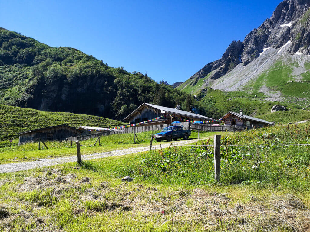
Day 3: Col de la Croix du Bonhomme – Rifugio Elisabetta
Route: Col des Fours – Tête Nord – La Ville des Glaciers – Mottets – Col de la Serigne – la Casermetta – Rifugio Elisabetta
Start the day by heading behind the refuge to begin the Col des Fours variant. The steep climb leads to Tête Nord des Fours (2756m), offering incredible panoramic views. After soaking in the scenery, descend to Col des Fours, where early-season snow may cover the trail.

Continue down into the valley, passing through Ville des Glaciers and crossing a bridge to rejoin the official Tour du Mont Blanc route. From there, tackle the ascent to Col de la Seigne (2516m), the border between France and Italy, with breathtaking views of the Italian Alps.

Finally, descend into Italy, enjoying the stunning landscapes as you make your way to Rifugio Elisabetta, where you’ll spend the night.
Stay at Rifugio Elisabetta, as there isn’t any camping option there.
Tour du Mont Blanc Stage 3 Hiking Stats:
- Distance: 17km
- Highest point: 2,727m
- Lowest point: 1,777m
- Elevation gain: 1,214m
- Elevation loss: -1454m
Facilities at Rifugio Elisabetta:
- Service: Toilets, hot showers for 2€, electricity in the common area, sinks, café/bar, restaurants, drinkable water
- Online: No coverage of the area
- Cost: 48€ per person in a dormitory half-board, 62€ per person in a double room half-board, 2€ for a shower. Cash Only.
Read: Stage 3: Les Chapieux to Rifugio Elisabetta
Variant 1: Stay in Cabane du Combal
If you want to extend your hike, continue for about an hour down the valley from Rifugio Elisabetta to Cabane du Combal. This peaceful spot offers a more secluded overnight option with stunning valley views.
- Services: Toilets, hot showers, electricity, sinks, café/bar, restaurant, and drinkable water.
- Online: No mobile coverage in the area.

Variant 2: Camping Val Veny
For an alternative overnight stay, continue hiking for about two more hours after Cabane du Combal. Here, you’ll need to leave the official Tour du Mont Blanc route by crossing the bridge just before the Cabane du Combal and continuing through the Val Veny valley. If you’re trekking in July or August, you’ll find a bus service available along this route, making it easier to reach the campgrounds.
In Val Veny, you’ll find three campgrounds located next to each other:
Facilities
- Services: Toilets, hot showers, electricity, sinks, café/bar, restaurant, and drinkable water.
- Online: 3G Network coverage.
The next day, you can either take the bus or hike back to Lac Combal to continue following the Tour du Mont Blanc trail. Alternatively, you can head directly to Courmayeur, but this means skipping a particularly scenic section of the trek.

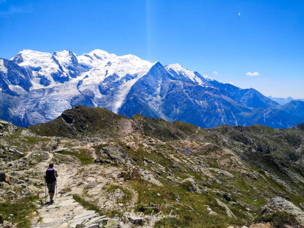
Day 4: Rifugio Elisabetta – Courmayeur
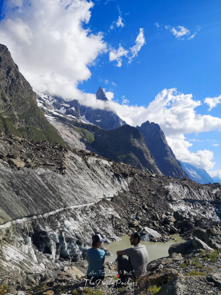
Follow the traditional Tour du Mont Blanc route, but make a detour to visit Cabane du Combal and the stunning Miage Lake and Glacier.
After taking in the views, rejoin the main Tour du Mont Blanc trail and continue towards Courmayeur.
If you’re hiking in mid-July or August, you can shorten the descent into Courmayeur by taking the cable car from Plan Chécrouit, cutting about 1 hour and 30 minutes of hiking.
Tour du Mont Blanc Stage 4 Hiking Stats:
- Distance: 15 km
- Highest point: 2,424m
- Lowest point: 1,176m
- Elevation gain: 648m
- Elevation loss: -1,625
Stay at Hotel Stella Del Nord, conveniently located just before Courmayeur. This cozy hotel offers a comfortable stay with great amenities, making it a perfect place to rest after a long day on the Tour du Mont Blanc.
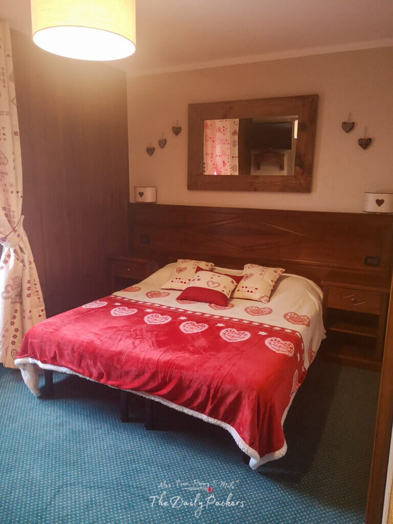
In Courmayeur/Dolonne, stay at Hotel Stella Del Nord
- Service: Toilets, hot showers, electricity in the room, sinks, café/bar, restaurants, drinkable water, free sparkling and mineral water, free tea and biscuits, breakfast.
- Online: 4G coverage and WIFI
- Cost: 80€ + 2€ staying fees

Read: Stage 4: Rifugio Elisabetta to Courmayeur
Variant 1: Camping Grande Jorasses
When you arrive in Courmayeur, you will pass by the bus station. From there, hop on the free shuttle 924 toward Val Ferret to reach Camping Grandes Jorasses. This is a convenient and easy way to get to your campsite without extra effort after a long day on the Tour du Mont Blanc.
- Service: Toilets, hot showers, electricity, sinks, café/bar, pizzeria, drinkable water.
- Online: 4G coverage

Check our Google Map of the Tour du Mont Blanc
Day 5: Courmayeur – Rifugio Bonatti
Route: Courmayeur – Rifugio Bertone – Rifugio Bonatti
This is one of the shortest days on the Tour du Mont Blanc. The day starts with a steady uphill climb to Rifugio Bertone (about 2 hours).
From there, follow the official Tour du Mont Blanc trail towards Rifugio Bonatti, one of the most scenic sections of the entire trek. Once past Bertone, the views become absolutely breathtaking.
We reached Rifugio Bonatti by 1:35 PM, after approximately 5 hours of hiking.

Tour du Mont Blanc Stage 5 Hiking Stats:
- Total distance: 11.9 km
- Elevation gain: +1,373m
- Elevation loss: -533m
- Highest elevation: 2,171m
- Lowest elevation: 1,205m

Be sure to book your stay at Rifugio Bonatti
Stay at Rifugio Bonatti
- Services: Toilets, hot showers, electricity in rooms, sinks, café/bar, restaurant, drinkable water, breakfast.
- Connectivity: 4G coverage available.
- Cost: €160 (2–4 bed room, half board).
Read: Stage 5: From Courmayeur to Bonatti
Variant 1: Camping
Camping Options on Stage 5
If you prefer to camp instead of staying at Rifugio Bonatti, you’ll need to descend into the Val Ferret Valley, where you’ll find a few campgrounds such as:
During high season, shuttle buses run between the valley and the campgrounds, making it easier to connect back to the trail.
Campground Services:
- Toilets and hot showers
- Electricity
- Sinks and drinkable water
- Café/bar and pizzeria
- 4G coverage available
Variant 2: Stage 6
If you find this stage too short and want to keep going, you have several options to extend your hike further along the Tour du Mont Blanc.
Option 1: Hike to Chalet Val Ferret or Rifugio Elena
You can continue to Rifugio Elena, located just before the border into Switzerland. This option adds 7.17 km with an elevation gain of +500m and descent of -478m, making it a reasonable extension for the day.

Option 2: Combine Stage 5 and Stage 6
For those looking for a long and challenging day, you can push through all the way to the end of Stage 6, crossing into Switzerland and reaching La Fouly.
- Total Distance: 19.3 km
- Elevation Gain: +1133m
- Elevation Loss: -1557m
- Highest Elevation: 2538m
- Lowest Elevation: 1600m
At the end of the day, you’ll be staying at one of the accommodations available in La Fouly or camping in the valley. This will allow you to shorten your overall trek by one day and enjoy a well-deserved rest in Switzerland.
Day 6: Rifugio Bonatti – La Fouly
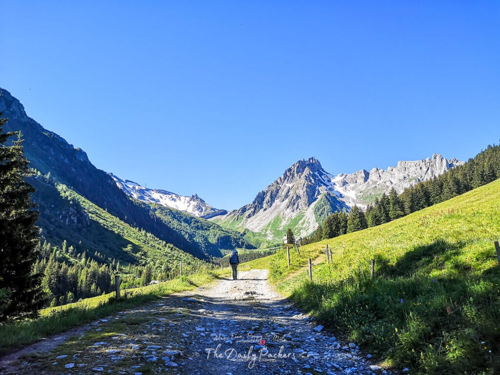
Waking up at Rifugio Bonatti with breathtaking views of Mont Blanc is an unforgettable experience. This stage of the Tour du Mont Blanc is one of the most scenic, offering panoramic landscapes as you make your way toward Switzerland.
The day begins with a beautiful descent to Chalet Val Ferret, followed by a steady uphill hike to Rifugio Elena. From there, the climb continues to Grand Col Ferret (2538m), marking the border between Italy and Switzerland.

As you cross into Switzerland, the descent begins, leading into the stunning Val Ferret Valley. The trail winds through alpine meadows and charming Swiss scenery before arriving in La Fouly, where you’ll set up camp for the night.
Tour du Mont Blanc Stage 6 Hiking Stats:
- Total Distance: 19.3 km
- Elevation Gain: +1133m
- Elevation Loss: -1557m
- Highest Elevation: 2538m
- Lowest Elevation: 1600m
Where to Stay: Camping des Glaciers
Facilities at Camping des Glaciers
- Facilities: Toilets, hot showers, electricity, sinks, a restaurant, drinkable water, and a small shop.
- Connectivity: 4G coverage and WiFi available.
- Cost: 27€
Read: Stage 6: From Rifugio Bonatti to La Fouly
Variant 1: Hotel
If you prefer to stay in a hotel or a mountain hut, there are a few options as you are in La Fouly:
And even a few more options a bit before la Fouly.
Day 7: La Fouly – Champex
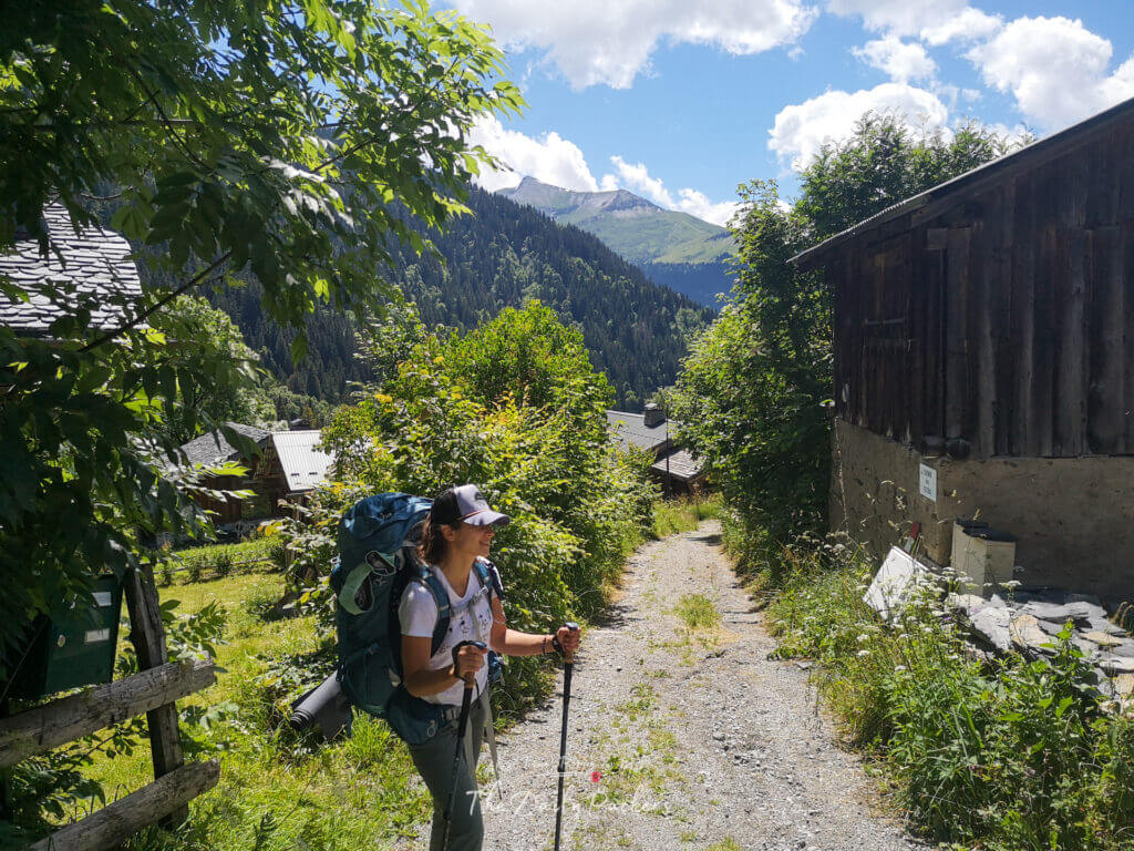
The Swiss section of the Tour du Mont Blanc takes you further away from Mont Blanc itself, making this part of the trail less scenic than the dramatic alpine sections. However, it still offers charming Swiss valleys, quaint villages, and peaceful forests as you start looping around the mountain range to return to the French side.
The day begins with an easy walk through a picturesque valley, passing traditional Swiss villages. After this pleasant start, the trail transitions into a steady uphill climb through dense forests, which lasts for most of the day. Eventually, you’ll descend toward Champex-Lac, a small alpine town set beside a stunning mountain lake.
Tour du Mont Blanc Stage 7 Hiking Stats:
- Total Distance: 15.9 km
- Elevation Gain: +1203m
- Elevation Loss: -1330m
- Highest Elevation: 1671m
- Lowest Elevation: 1051m

Where to Stay: Camping Les Rocailles
Facilities at Camping Les Rocailles
- Facilities: Toilets, hot showers, electricity, sinks, restaurant, drinkable water, and a small shop.
- Connectivity: 4G coverage and WiFi available.
- Cost: 35.70€

Read: Stage 7: From La Fouly to Champex-Lac
Variant 1: Hotel
If you prefer to stay in a hotel or a mountain hut, there are a few options as you are in Champex:
- Hotel Auberge: Au Vieux Champex

Variant 2: Col d’Arpette
If the weather is clear and sunny, taking the Fenêtre d’Arpette variant is highly recommended for some of the most dramatic and rewarding views on the Tour du Mont Blanc. This high-altitude route offers a more challenging and rugged climb, but the effort is well worth it for the breathtaking panoramas.
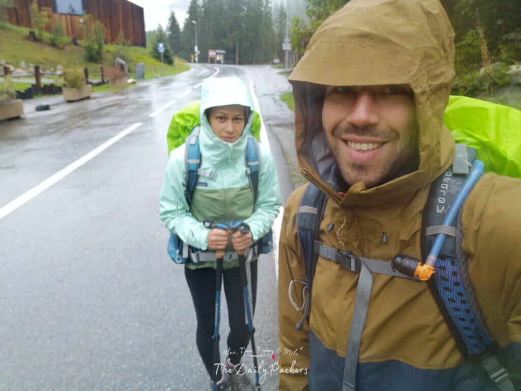
Unfortunately, on our trek, rainy conditions forced us to take the official route instead. Since the Fenêtre d’Arpette is steep and rocky, bad weather can make it dangerously slippery, and fog can reduce visibility significantly.
If you decide to take this alternative route, walk past Champex-Lac and continue for about 1.5 km to reach Hôtel Relais d’Arpette, where you can also find camping options. This is a great place to stay overnight before tackling the Fenêtre d’Arpette the next day.

Check our Google Map of the Tour du Mont Blanc
Day 8: Champex – Le Peuty
Route: Champex – Plan de l’Au – Bovine – Col de Forclaz – Trient – Le Peuty
This stage was one of the least enjoyable for us due to non-stop rain, making the trail muddy and visibility poor. However, in good weather, this section can be a rewarding forested climb with occasional panoramic views.

The day starts with a relatively easy walk through the valley before transitioning into a steep forest ascent toward Bovine, a well-known high-pasture area. After reaching the top, the trail flattens out slightly, offering some relief before descending into Trient and then Le Peuty, where we camped for the night.
Tour du Mont Blanc Stage 8 Hiking Stats:
- Total distance: 17.1 km
- Elevation gain: +1562 m
- Elevation loss: -1372 m
- Highest elevation: 2053 m
- Lowest elevation: 1282 m

Stay at Camping Le Peuty
This is one of the most basic campgrounds on the Tour du Mont Blanc; it belongs to the town hall, is free, and no reservation is needed, making it a budget-friendly option.
Facilities:
- Toilets (no toilet paper)
- Basic showers (cold water)
- One electricity outlet (limited availability)
- Sinks & drinkable water
- Nearby restaurant
- 4G coverage available
- Cost: 0€

Read: Stage 8: Champex to le Peuty
Variant 1: Camping/Hotel de la Forclaz
If you’re looking for a more comfortable camping option, you can stay at Hôtel de la Forclaz, which offers a designated camping area with better facilities than Le Peuty. However, staying here will make your next day longer, as you’ll need to walk down to Le Peuty the following morning before starting Stage 9.
This option is great if you prefer hot showers, more amenities, and a better night’s sleep, but keep in mind the extra distance added to the next day’s hike.
Variant 2: Hotel
If you’re looking for a more comfortable stay instead of camping at Le Peuty, Trient offers a few great options:
- L’ Auberge du Mont Blanc
- La Grande Ourse
Day 9: Le Peuty – Tre-le-champ
Route: Le Peuty – Col de Balme – Aiguillette des Posettes – Tre-le-Champ
Today, we leave Switzerland behind and re-enter France, marking the beginning of the most scenic part of the Tour du Mont Blanc. From here on, expect stunning views of Mont Blanc that will accompany you until the end of the trek.

Start the day with a steady ascent to Col de Balme, where a mountain hut awaits—a perfect spot for a well-deserved break. From there, the trail leads to Aiguillette des Posettes, featuring a small descent followed by a short climb. The final stretch is a long descent to Tre-le-Champ, where you’ll spend the night.
Tour du Mont Blanc Stage 9 Hiking Stats:
- Total distance: 13.6 km
- Elevation gain: +1231 m
- Elevation loss: -1116 m
- Highest elevation: 2208 m
- Lowest elevation: 1283 m

Where to Stay: Auberge de la Boerne (Camping & Hut Options)
Facilities at Auberge de la Boerne
- Facilities: Toilets, hot showers, electricity, sinks, restaurant, drinkable water
- Internet: Poor 4G at the camping spot, strong on the road, WiFi available
- Cost: 16€
If you prefer a mountain hut experience, the Auberge de la Boerne also offers dormitories, private rooms, and tent rentals for added comfort.

Read: Stage 9: Le Peuty to Tre-le-champ
Day 10: Tre-le-champ – La Flégère
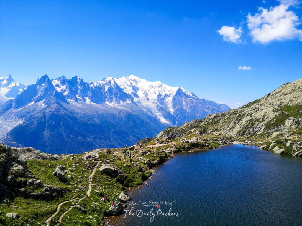
Route: Tre-le-Champ – Lac de Chéserys – Lac Blanc – La Flégère
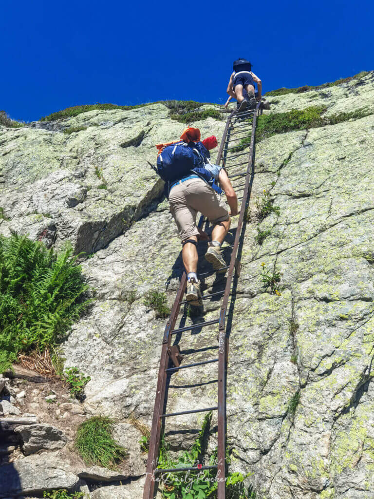
Today is one of the most unique stages of the Tour du Mont Blanc, featuring incredible scenery and the famous ladders—a thrilling yet manageable section of the trail. The ascent toward La Flégère starts gently before leading to the metal ladders, which allow hikers to navigate the steep cliffs safely. These ladders are suitable for everyone, and we even saw older hikers and kids using them with ease.

At the intersection near Tête aux Vents, you have the option to head straight to La Flégère, but we highly recommend taking the scenic route via Lac de Chéserys and Lac Blanc. These alpine lakes offer breathtaking reflections of the surrounding peaks and are among the most beautiful spots on the Tour du Mont Blanc. The extra detour is well worth it and won’t add too much distance to this relatively short stage.
Tour du Mont Blanc Stage 10 Hiking Stats:
- Total distance: 8.13 km
- Elevation gain: +1166 m
- Elevation loss: -685 m
- Highest elevation: 2351 m
- Lowest elevation: 1398 m

Where to Stay: Refuge de La Flégère (Camping & Hut Options)
Facilities at Refuge de La Flégère
- Facilities: Toilets, restaurant
- Internet: Weak 4G at the camping spot, strong on the main road, WiFi available
- Cost: Free (for camping)
Additional Notes:
- If you have dinner at the refuge, you can access hot showers for 2€.
- If you buy a drink, you can charge your electronics and refill your drinkable water.
- The refuge also offers rooms and dormitories for those preferring indoor accommodation.
Read: Stage 10: From Tre-le-champ to La Flégère
Day 11: La Flégère – Les Houches
Route: La Flégère – PlanPraz – Brévent – Col de Brévent – Les Houches
The final stage of the Tour du Mont Blanc is as stunning as it is rewarding. The day begins with a relatively gentle and scenic walk from La Flégère to PlanPraz, offering breathtaking views of Mont Blanc. From PlanPraz, the trail ascends toward Brévent, where a few more ladders await before reaching Col de Brévent (2480m), the highest point of the day. The panoramic views from the top make this climb totally worth the effort.

After soaking in the incredible scenery, it’s time for the long descent back to Les Houches. The first section is a rugged, rocky trail, followed by a more gradual forested descent. While the final stretch can feel long, the satisfaction of completing the Tour du Mont Blanc keeps you going!
Tour du Mont Blanc Stage 11 Hiking Stats:
- Total distance: 18 km
- Elevation gain: +1270 m
- Elevation loss: -2145 m
- Highest elevation: 2480 m
- Lowest elevation: 978 m

Where to Stay: Camping Bellevue (Les Houches)
Facilities at Camping Bellevue (Les Houches)
- Facilities: Toilets, sinks, hot showers, electricity, drinkable water
- Internet: 4G coverage
- Cost: 16€
If you prefer more comfort, now that you’re back in the valley, you can find accommodations in Les Houches, Chamonix, or nearby towns. Regular buses connect Les Houches to other areas, making it easy to reach your next stay.

Read: Stage 11: From La Flégère to Les Houches
Cost of the Tour du Mont Blanc
Without taking into account the transportation or the food (only half board when mandatory in Italy), and if you follow the same route we did, you will be spending for 2:
- Camping le Pontet: 17€
- Shower in Refuge Col de la Croix du Bonhomme : 6€
- Rifugio Elisabetta: 128€
- Hotel Stella del Nord: 82€
- Rifugio Bonatti: 160€
- Camping des Glaciers: 27€
- Camping des Rocailles: 35.70€
- Camping le Peuty: 0€
- Auberge de la Boerne: 16€
- La Flégère: 0€
- Camping Bellevue: 16€
To sum up, the total cost of the Tour du Mont Blanc for 2 will be 487.7€, plus the food along the way.

Check our Google Map of the Tour du Mont Blanc
About the authors
We are Alex and Tina, a French-Serbian couple who met in China back in 2014. We spent three incredible years there before making France our home. Our shared passion for travel has been the heartbeat of our relationship for over 12 years, taking us across 44 countries and counting.
We launched TheDailyPackers in 2019 as a way to document our adventures. In 2026, we reached a major milestone by officially turning our blog into our full-time job. While we are still growing toward financial independence through this platform, every article we write is fueled by our mission to make your voyages easier through in-depth guides, honest advice, and the lessons we’ve learned from our own mistakes.
Our journey has not been without its storms. In 2023, our world changed forever when our first son, Poppy, was stillborn on November 25th. It was, and remains, the hardest chapter of our lives. In 2025, we were blessed with our second little boy, Milo. He has since joined our traveling tribe, and you’ll be seeing him—and the reality of traveling with a little one-on the blog more and more.
We hope to inspire you to explore the world with curiosity and resilience. Thank you for being part of our story.
You may also like those related posts
Kaunas to the Curonian Spit: The Ultimate 1-Day Road Trip Guide
10 Best things to do in San Pedro de Atacama in 2 to 3 days
7 Real Downsides of Traveling Without a Plan
21 Best things to do in Regensburg, Germany, in 2 to 3 days
19 Best Things to do in Brussels, Belgium, in 1 to 3 days
Kaysersberg Christmas Market: The Most Magical of Alsace
8 Best Hikes in Argentina You Shouldn’t Miss on Your Next Trip
Gauja National Park: Latvia’s most incredible park in 2 days
Pssst, did you know that…
If you purchase something through our links, we earn a small fee. However, you still pay the same. Win-win! And one day we may get to be full-time travel bloggers =)
Find Hotels with Booking.com
Do Yoga with KVY
Buy us a Coffee
Rent a car with DiscoverCars
Find Attractions with GetYourGuide
Find Flights with Expedia
Buy an eSIM with Airalo
Get insured with World Nomads
Get ready with Amazon.com